

There are several streets around town that don’t seem to be where they ought to be. As a native Brooklynite, I protest the notion of a Manhattan Ave.
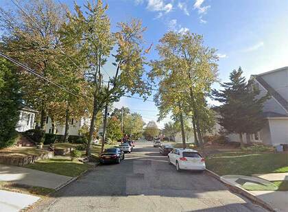
Manhattan Ave., like its parallel routes in East Williamsburg and Greenpoint, runs according to house numbers from Broadway (just north of Flushing Ave.) north and northwest to Newtown Creek. Until about 1886, Manhattan Ave., or rather the route it would eventually follow, was known as Ewen St. (for 19th-century city surveyor Daniel Ewen) from Broadway to about Richardson St.; Orchard St., from Van Pelt (now Engert) Ave. north to Greenpoint Ave.; and Union Ave. (in the colonial era, Hill Rd.), the rest of the way. In 1886, Union Ave. and Orchard St. became Manhattan Ave., which, at the time, remained separate from Ewen. In May 1897, the entire stretch became Manhattan Ave.; at that time Daniel Ewen became lost to memory, as far as a NYC street name remembrance goes.
In 1909 the City created a large, rambling park on the Greenpoint-Williamsburg border, between roughly Nassau Ave., N. 12th, Bayard, Leonard, Lorimer Sts. and Driggs Ave., naming it McCarren Park after a just-deceased, prominent local state senator. The creation of the park gave city engineers a chance to re-jigger the street layout, and Manhattan Ave. to the north was united with the old Ewen St. section, creating a direct north-south route, and Manhattan Ave. as we know it was created.
My objection? Would there ever be a street named for Brooklyn on Manhattan Island? Some Manhattanites rarely visit Brooklyn or any other borough, and are proud of the fact.
Tottenville, Staten Island is the southern point of New York State and give its suburban nature (and rural until a couple of decades ago) and its mostly conservative politics, Manhattanites would rather Staten Island secede from New York City or be annexed by New Jersey. That’s why the presence of a Manhattan St. in Tottenville is perplexing. It’s even more unlike Manhattan than Brooklyn’s Manhattan Ave., as it’s lined by street trees and private homes on single plots. A couple of blocks away is Rockaway Str., itself set apart from the Rockaways in Queens by several miles.
Nassau Blvd. isn’t in Nassau County, but it goes there. Horace Harding Blvd. was initially developed as a through route from Elmhurst to Nassau County as Nassau Blvd. in the 1930s, and was later named for a financier and friend of NYC traffic czar Robert Moses. It was widened into the Long Island Expressway in the 1950s, with Harding’s name still affixed to the service roads. Today the LIE runs from the Queens Midtown Tunnel to near Riverhead in Suffolk County as Interstate 495. In “rush” hours, it’s been dubbed “the world’s longest parking lot.”
However, a short piece of the original Nassau Blvd. can be found for approximately two blocks in Little Neck as the LIE was dipped south of its original route. This short two-lane piece runs from the north service road of the LIE, runs east past Little Neck Parkway and 260th St., and into Nassau County—where it changes names to become Horace Harding Blvd. once again in Lake Success, where it angles southeast into the north service road of the LIE once again, with its two-way traffic ending at Lakeville Rd.
This is one of two roads in Queens named for Nassau County, though Nassau Rd. is just over the city line past Glenwood St. in northern Little Neck. Further south, the Nassau Expressway (I-898) parallels the Belt Parkway east of Kennedy Airport.
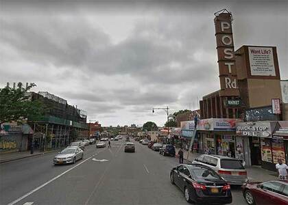
Isn’t Boston Rd. the southern leg of the Boston Post Rd., the colonial-era route to Boston? Isn’t it true that if you follow Boston Rd./US Route 1 northeast, you’ll wind up in Boston? All true. But the Bronx Boston Rd. is not the original Boston Post Rd., no matter what the old theater marquee says.
According to the late Bronx historian John McNamara, Boston Rd. was constructed by surveyor John B. Coles in 1794. It’s a reroute of the original Boston Post Rd., which was started in 1672 as a mail route between Boston and NYC (a 270-mile distance), following a network of Indian trails. The original branched off north of the present Boston Rd. in the northern Bronx; its present route is marked by Kingsbridge Rd. in Mount Vernon and by Bussing Ave., Barnes Ave. and Gun Hill Rd. in the northern Bronx. Lewis Morris, an early Bronx honcho, wanted the Post Rd. to run through his property; enter John Coles.
Early on, that road was known as Coles’ Boston Rd.. North of what would become the Bronx-Westchester line, the two roads converged and continued north. Further north, the Post Rd. would separate into more tributaries, each reaching Boston via a separate route. In those days, what takes a few hours by car took a few days by horse or coach.
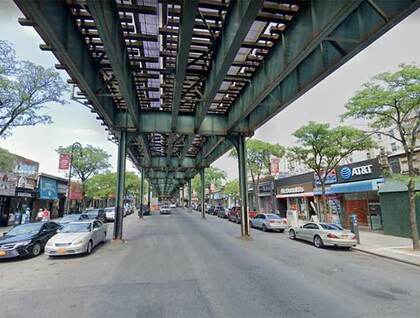
This is one of the Bronx’s longest roads, running from the East River in Clason Point on the south to the Mount Vernon border on the north. Most of the northern half of the road is shrouded by the elevated train carrying the #2 to Wakefield. It doesn’t go directly to White Plains once you enter Westchester County, though. To get to that town, your best bet is to take West 1st Ave. (which continues the route in Mount Vernon); turn left at West Lincoln; continue to NYS Route 22 (North Columbus Ave.) which runs into the heart of White Plains. In Bronxville, Route 22 is named White Plains Rd.
The north end of the Bronx’s White Plains Rd. from Pelham Parkway was laid out in 1863, while the southern half came later. It was named similarly to Flushing Ave. (see below), as a network of roads would get you to White Plains from its northern end.
Probably the most egregious example of “Where does it go?” in New York City is Flushing Ave., which runs for miles from the Brooklyn Navy Yard east and northeast, ending at Grand Ave. in Maspeth, nowhere near its titular neighborhood; it would have to go a few miles more to get that far. How did this street become Flushing Ave.?
Flushing Ave. takes its unusual name because of the relative isolation of Flushing, Queens. In the colonial era, marshy land and creeks cut Flushing off from traffic from the west, and as there were few good roads into Flushing, carts and coaches had to first go to Jamaica and travel north from there.
Flushing Ave., in the past, was a toll road built to be an alternative to the southern approach. It would eventually lead to Newtown (a large area, known today as Elmhurst and northern Maspeth) and then to Flushing via North Hempstead Turnpike (what is now approximately 63rd Rd.) and then along either now-vanished roads (Strong’s Causeway, obliterated in the 1950s by the Long Island Expressway) or all-but-vanished roads (Head of the Vly Rd., now a short lane called Vleigh Pl.) into Flushing.
The westernmost section is the oldest, dating to the colonial era and earlier; it ran east from the now-filled Wallabout Mill Pond in what is now the Navy Yard east to Bushwick Ave. (At its western end, Flushing Ave. becomes Nassau St.; further east, a short street just south of Flushing Ave. and Kent Ave. is called Little Nassau St.) By about 1805, tolls were charged and the road was known as the Brooklyn and Newtown Turnpike. (A long wooden pole, or pike, was placed across the road; this pike was turned, or moved out of the way, when the toll was collected.)
The Brooklyn and Newtown Turnpike was extended to Broadway in 1850, and to Bushwick Ave. in 1858. Beyond Bushwick Ave. the road ran in a circuitous fashion to avoid hills. In 1868, the hills were leveled, the road was straightened and, by 1893, the road had its present form and length it has today, extending out to the junction at Grand St. (later Ave.) and Maspeth Ave. (To muddy the water further, an even older road extended southwest from what would be the Brooklyn and Newtown Turnpike at what would be Broadway in the colonial era, joining a highway known as Cripplebush Rd., which ran approximately in a north-south route where Bedford Avenue is today.)
—Kevin Walsh is the webmaster of the award-winning website Forgotten NY, and the author of the books Forgotten New York (HarperCollins, 2006) and also, with the Greater Astoria Historical Society, Forgotten Queens (Arcadia, 2013)